Maps
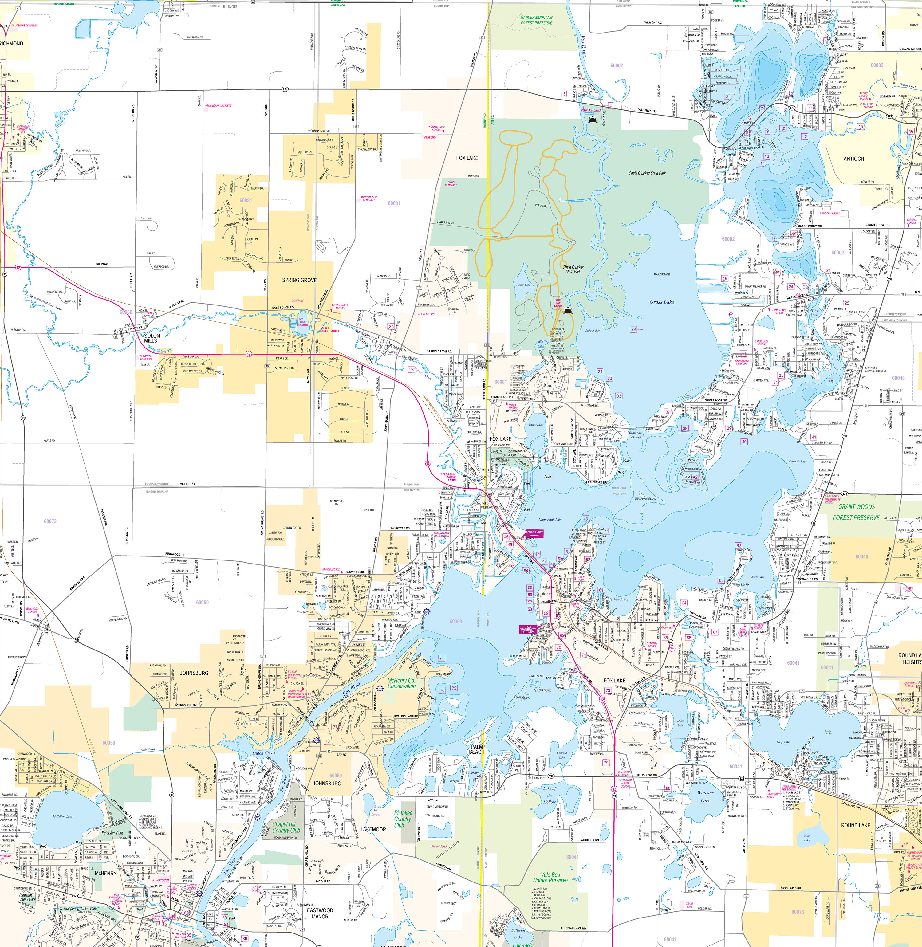
ZONE C – Chain O’Lakes
Zone C extends from the mouth of the Fox River at Pistakee Lake north to the Wisconsin state line, and includes all 15 of the inter-connected lakes in the system.
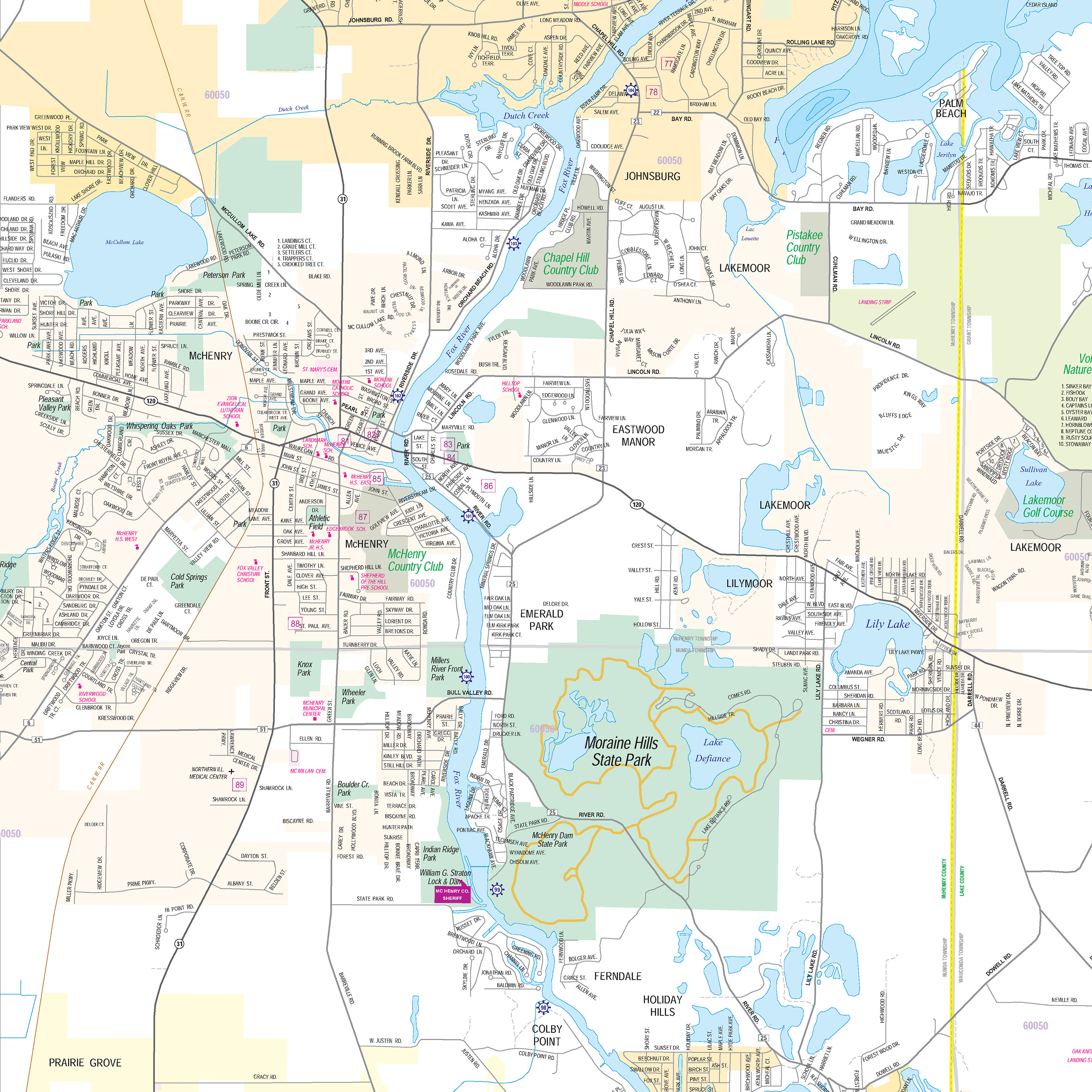
ZONE B – UPPER RIVER
Zone B extends north from the Wm. G. Stratton lock & dam near Mchenry, Illinois (river mile 99) to the entrance at Pistakee Lake (river mile 106). Mile markers are located along the shores of the waterway.
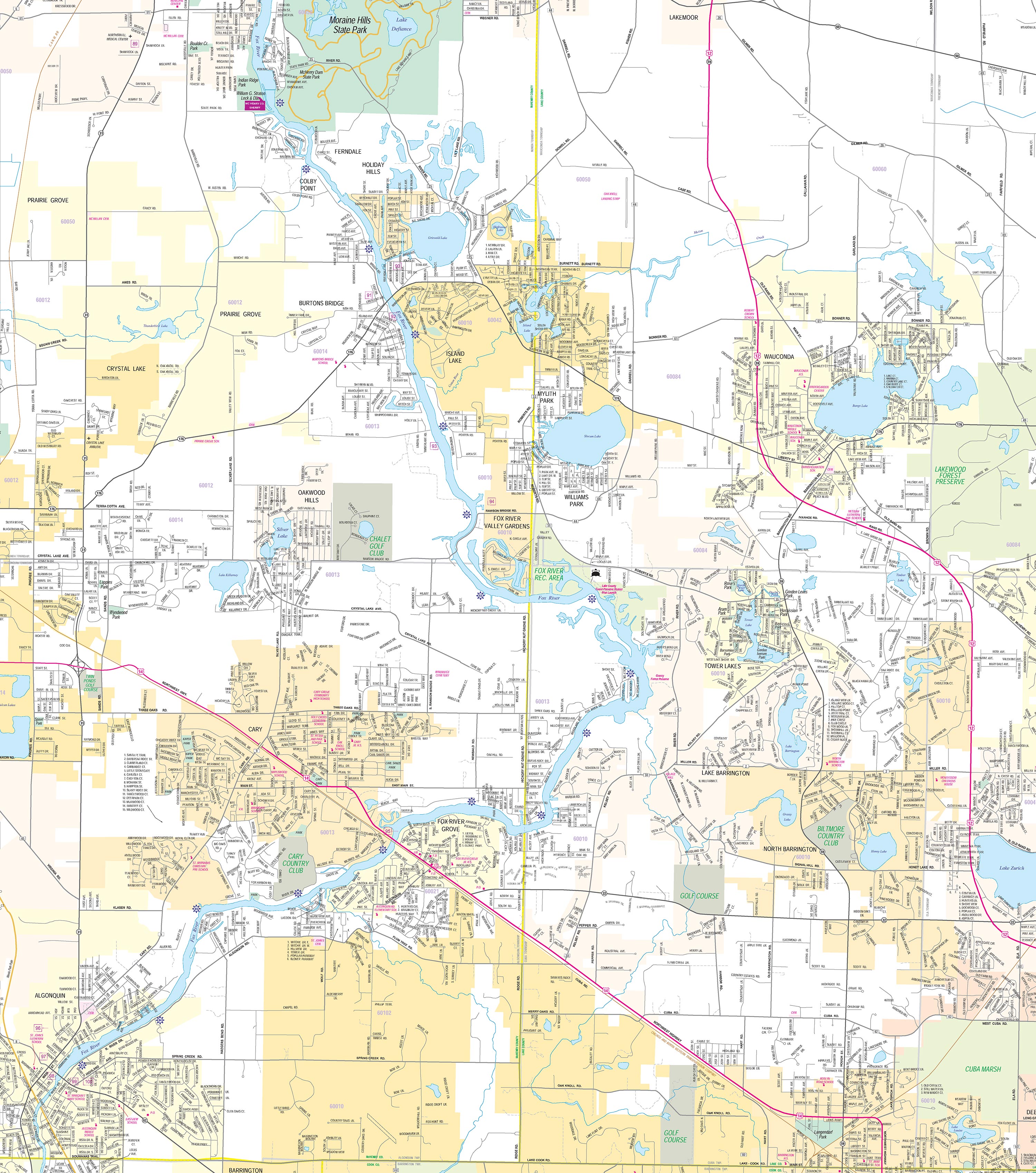
ZONE A – LOWER RIVER
Zone A extends north from the Algonquin dam in Algonquin (river mile 82.75), to the Wm. G. Stratton lock & dam near Mchenry, Illinois (river mile 99). mile markers are located along the shores of the waterway. navigation aids mark the channel north of Rawson’s bridge to the lock.


